Trail Location 8: History of the Watershed
Walking Tour? VIEW THE TRAIL LOCATION IN GOOGLE MAPS >
HISTORY OF THE WATERSHED
Thousands of years ago, the Lick Run watershed was at the bottom of a warm, shallow sea, which over time produced the rock layers of limestone, shale, and sandstone that are so familiar in our area. Sea plants and animals that lived during that time are commonly found in our local fossils.
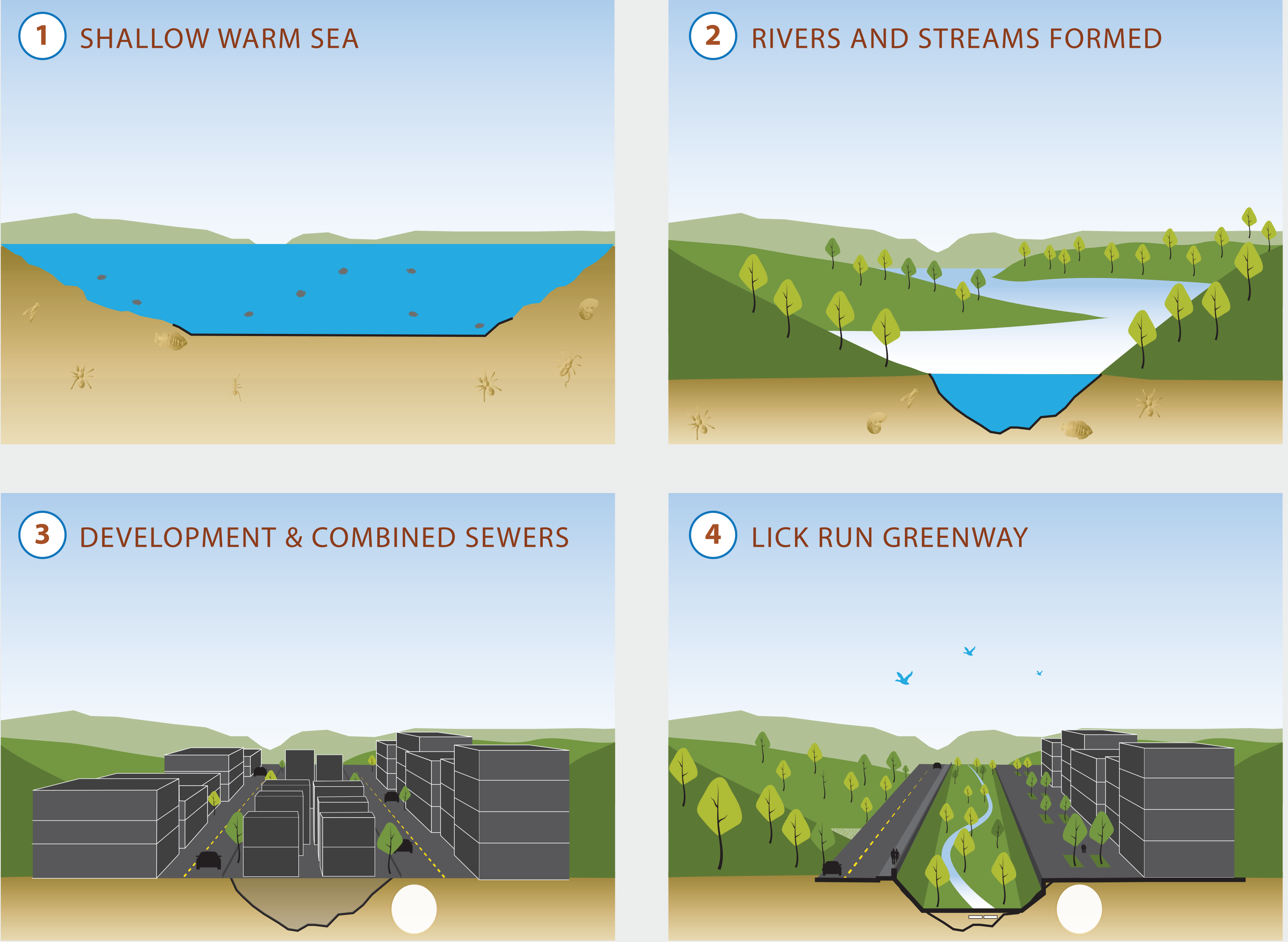
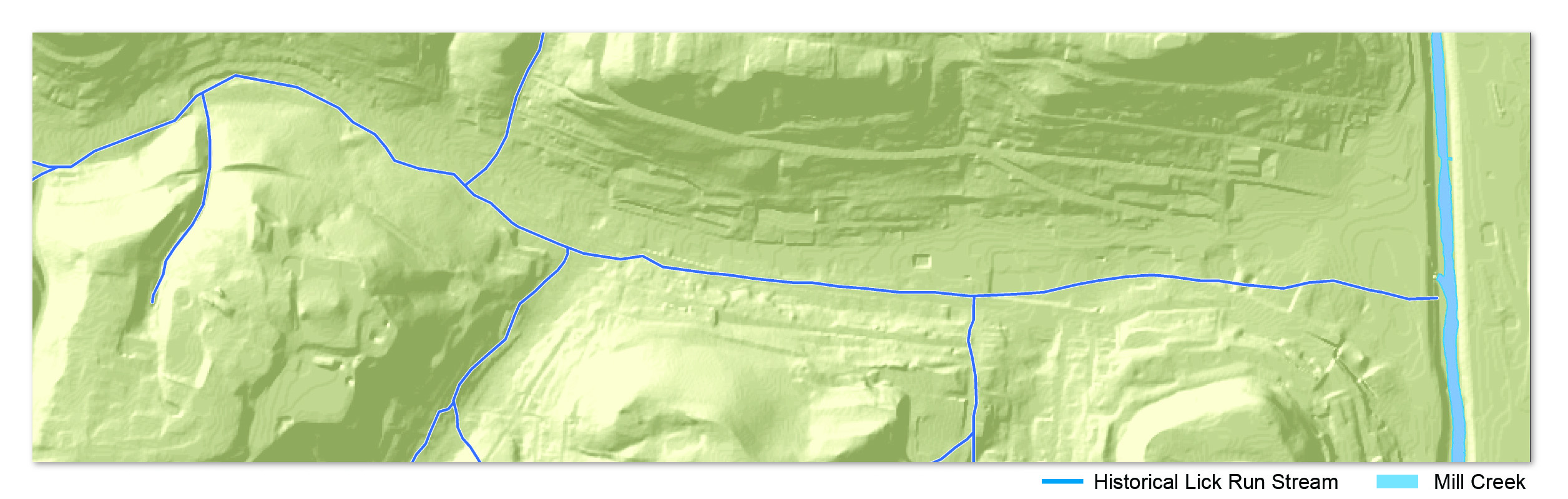
Eventually, the sea receded, formed rivers and streams and exposed the land, allowing trees and other plants to grow. One of the historic streams that flowed in this area was called Lick Run.
The headwaters of Lick Run were located in the hills west of Quebec Avenue. In its natural state, the Lick Run stream meandered in an easterly direction for roughly two miles before joining the Mill Creek. The current Queen City Avenue (formerly Lick Run Pike) is just north of where the Lick Run stream used to flow.
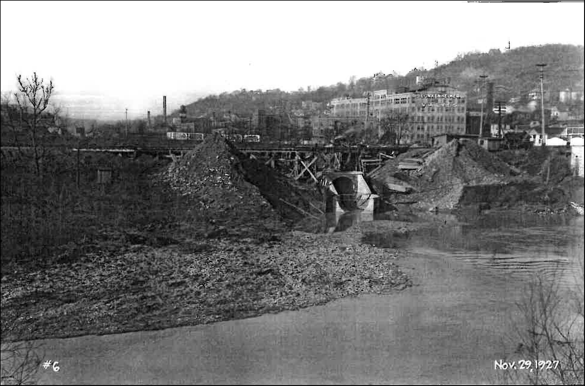
As population rose and development progressed during the late 19th century, the forested valleys and hills were cleared to make room for homes and businesses. Lick Run evolved from a natural stream bed to a straight ditch and then was enclosed within an underground sewer pipe. The Lick Run stream was soon forgotten as roads and buildings were built over the top.
As flooding and public health became a problem, the community demanded improvements. In 1893, the Lick Run stream was enclosed and buried within a nearly 20-foot-diameter brick combined sewer. The sewer carried wastes and water out of the community and into the Mill Creek. Until the 1950s, sewage was routinely discharged into waterways like the Mill Creek, solving local problems but ultimately polluting our rivers. Our waterways didn't become cleaner until the arrival of wastewater treatment and passage of the Clean Water Act in 1972.
Over time, however, a new challenge arose. Combined sewers, like the Lick Run sewer, began filling up with too much water during heavy rains and overflowing into waterways. This is known as a combined sewer overflow or CSO. By the early 21st century, millions of gallons of sewage and rainwater from the Lick Run watershed were overflowing into the Mill Creek each year.
The Lick Run Greenway not only reduces the overflows but restores the historical connection between rainwater and the Mill Creek. It's our generation's Lick Run.
The Lick Run Project removes about half a billion gallons a year of rainwater (aka stormwater) from the combined sewer system and carries or conveys it to the Mill Creek through the Lick Run Greenway (just like the original Lick Run stream used to do). The rainwater is collected by a combination of green infrastructure (e.g., bioswale and stream restorations) and dedicated underground storm sewers beneath most of the main streets in South Fairmount and the surrounding area.
Keeping stormwater out of the combined sewer system results in a significant reduction in CSOs into the Mill Creek each year and also reduces the amount of wastewater treated at the Mill Creek treatment plant.

- Cincinnati is one of about 772 cities across the U.S. with a combined sewer system.
- Combined sewers are underground pipes that collect sewage and rainwater in the same pipe. During heavy rains, they fill up with too much water, and a mixture of sewage and stormwater overflows into local waterways like the Mill Creek and Ohio River.
- These overflows are known as combined sewer overflows (CSOs). Not a good thing for people, fish, or anyone downstream from here.