Trail Location 3: A Story of Rainwater Runoff and a Community
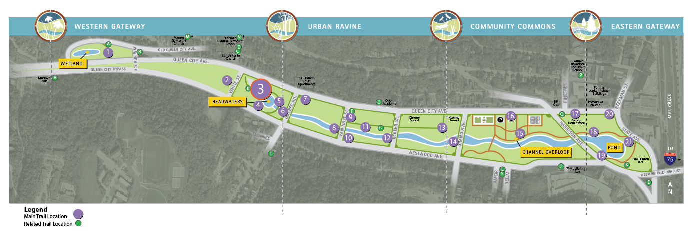
Walking Tour? VIEW THE TRAIL LOCATION IN GOOGLE MAPS >
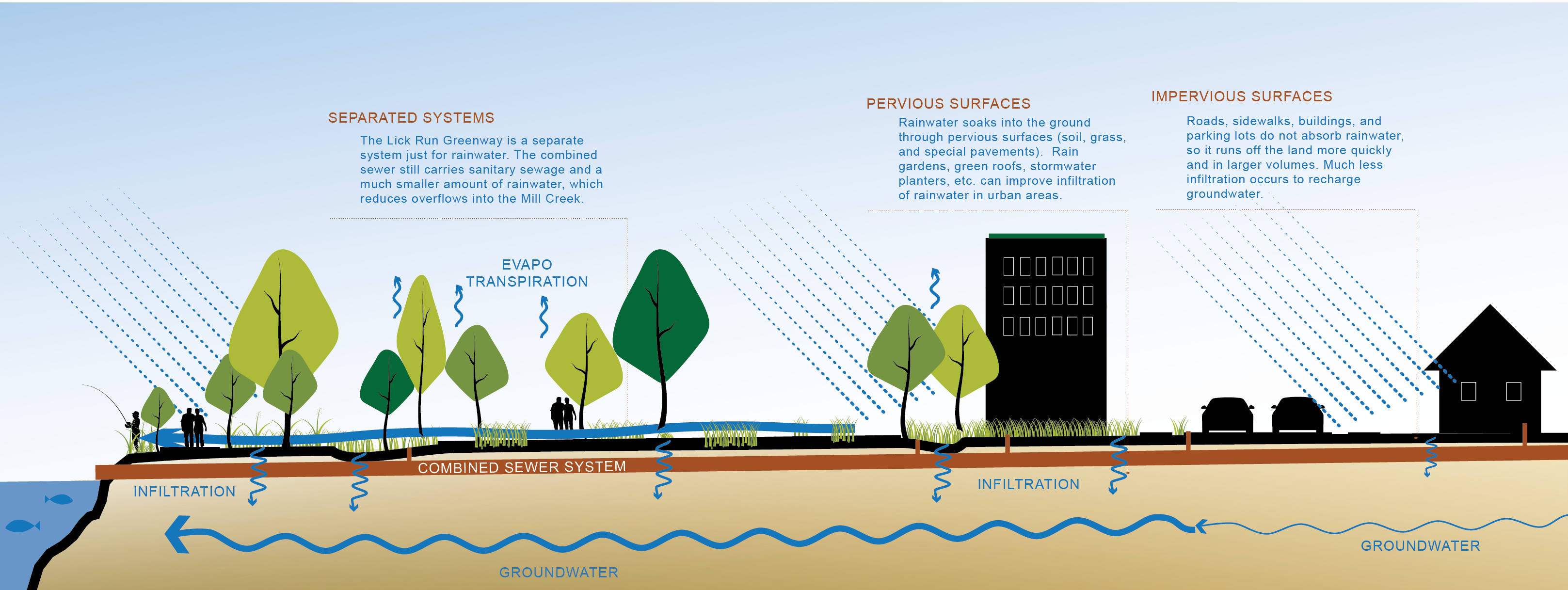
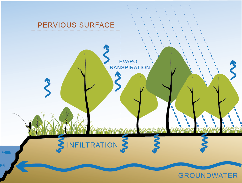
Prior to the late 1800s, a stream called Lick Run flowed naturally through this valley to the Mill Creek, a tributary of the Ohio River. The area that drained to Lick Run — about 2,700 acres between Harrison Avenue, Ferguson Road, Glenway Avenue, and the Mill Creek — became known as the Lick Run watershed. On its way to the stream, much of the rainwater soaked into the ground or was absorbed by plants (known as pervious surfaces).
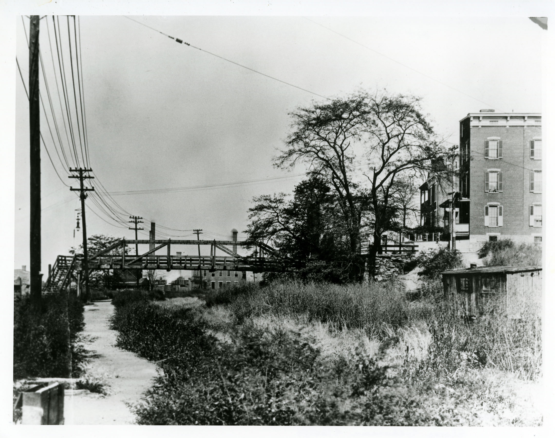
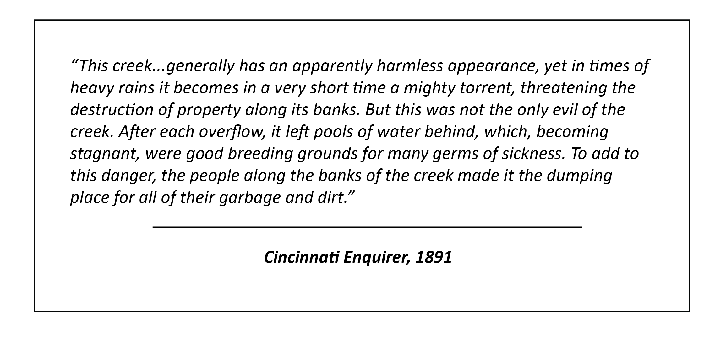
As people settled in the watershed, they replaced the pervious surfaces with impervious surfaces such as roads, sidewalks, buildings, and parking lots. This caused more rainwater to fill the stream, swelling its size. The stream also became a dumping ground for household wastes and sewage.
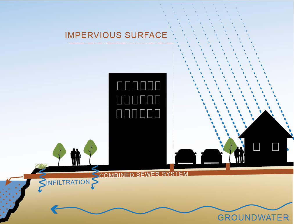
As flooding and public health became a problem, the community demanded improvements. In 1893, the Lick Run stream was enclosed and buried within a nearly 20-foot-diameter brick combined sewer. The sewer carried wastes and water out of the community and into the Mill Creek. Until the 1950s, sewage was routinely discharged into waterways like the Mill Creek, solving local problems but ultimately polluting our rivers. Our waterways didn't become cleaner until the arrival of wastewater treatment in the 1950s and 1960s and passage of the Clean Water Act in 1972.
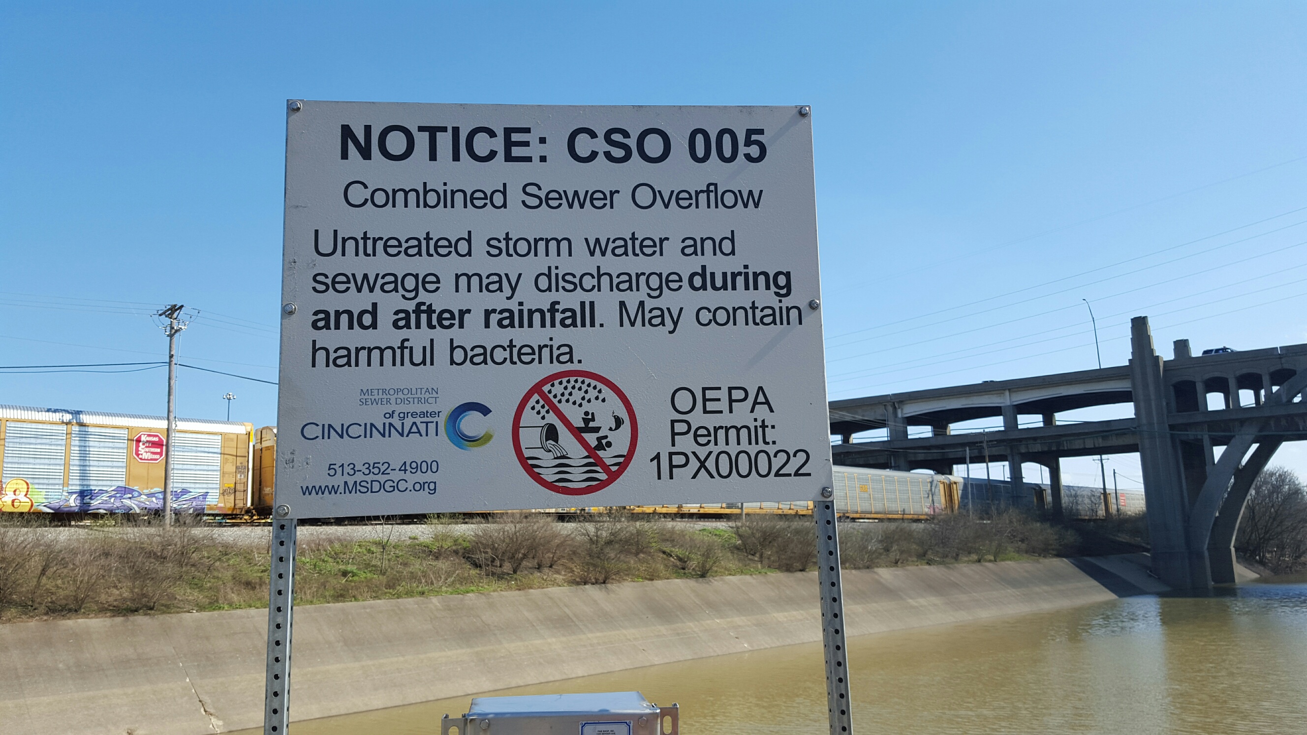
Over time, however, a new challenge arose. Combined sewers, like the Lick Run sewer, began filling up with too much water during heavy rains and overflowing into waterways. This is known as a combined sewer overflow or CSO. By the early 21st century, millions of gallons of sewage and rainwater from the Lick Run watershed were overflowing into the Mill Creek each year.
The Lick Run Greenway not only reduces the overflows but restores the historical connection between rainwater and the Mill Creek. It's our generation's Lick Run.
The Lick Run Project removes about half a billion gallons a year of rainwater (aka stormwater) from the combined sewer system and carries or conveys it to the Mill Creek through the Lick Run Greenway (just like the original Lick Run stream used to do). The rainwater is collected by a combination of green infrastructure (e.g., bioswale and stream restorations) and dedicated underground storm sewers beneath most of the main streets in South Fairmount and the surrounding area.
Keeping stormwater out of the combined sewer system results in a significant reduction in CSOs into the Mill Creek each year and also reduces the amount of wastewater treated at the Mill Creek treatment plant.