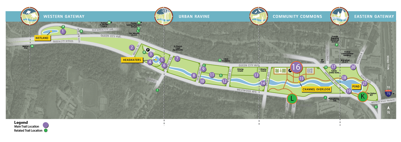
Trail Location 16: Public Infrastructure in South Fairmount
Walking Tour? VIEW THE TRAIL LOCATION IN GOOGLE MAPS >
The Public Infrastructure trail location includes a main stop at Trail Location 16 and three related stops:
- TRAIL LOCATION 16: PUBLIC INFRASTRUCTURE IN SOUTH FAIRMOUNT >
- TRAIL LOCATION K: GATEWAY TO THE WEST SIDE >
- TRAIL LOCATION L: FAIRMOUNT STREETCARS >
TRAIL LOCATION 16: PUBLIC INFRASTRUCTURE IN SOUTH FAIRMOUNT
The growth of South Fairmount over the past two centuries would not have occurred without the development of roads, public transportation, sewers, and other public infrastructure.
Getting Around
Transportation improvements during the 19th century helped connect Fairmount residents and industries to downtown Cincinnati. Initially, these improvements included Harrison Pike and the Cincinnati, Hamilton, & Dayton Railroad. However, many residents didn't own a vehicle and the railroad was too expensive for daily commuting.
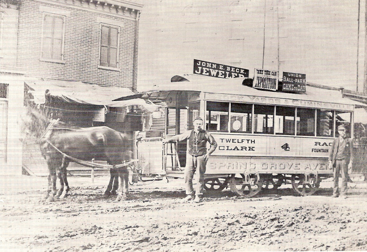
In the 1880s, a horse-drawn street car added tracks in Fairmount. Cincinnati was one of the first cities in the United States to adopt this form of public transportation. Known as a horsecar, it was successful because it was inexpensive, efficient, and spurred the arrival of more than a thousand new residents to the neighborhood between 1880 and 1890. By the 1890s, the streetcar ran on electricity, fueling an influx of even more residents.
However, just as transportation improvements helped build the community's population, transportation changes caused its decline.
In the 1970s, the City of Cincinnati converted both Queen City and Westwood avenues to one-way streets, making it difficult for commuters to stop and and shop at the small businesses along those roadways. This change, in combination with the loss of manufacturing jobs, resulted in the sharp decline of the neighborhood's population to approximately 6,800 residents by 1980.
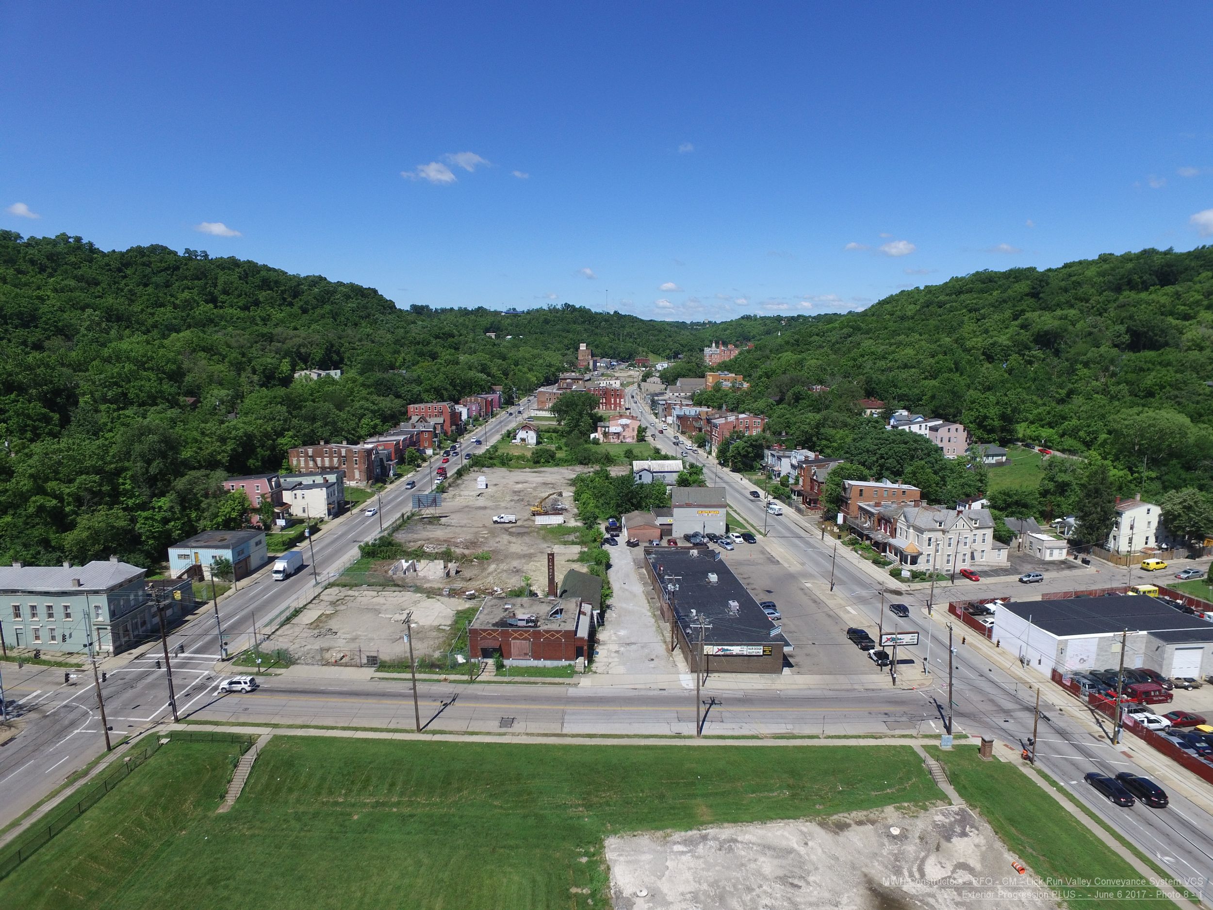
right) as a one-way street to the west, and Westwood (on the left)
as a one-way street to the east (2017)
New Sewer for South Fairmount
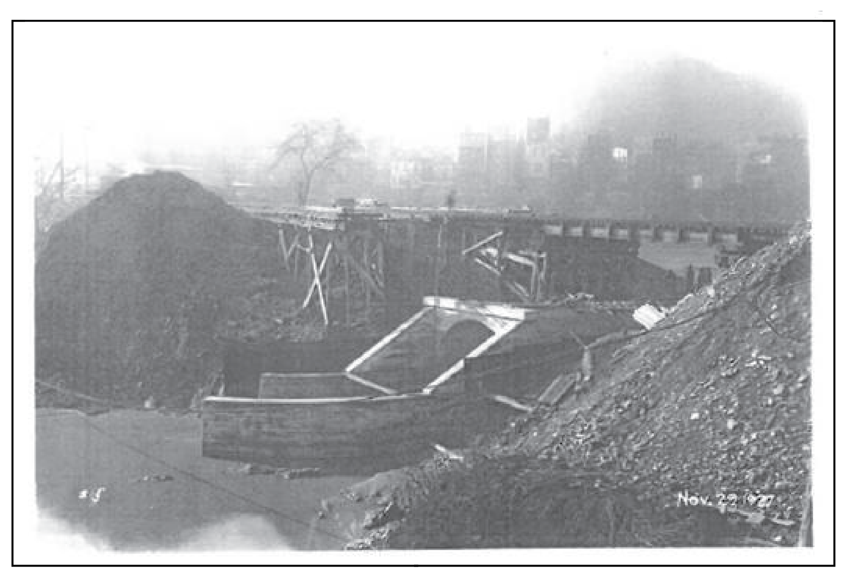
At the end of the 19th century, both businesses and residential development in Fairmount were on the rise. These new developments generated a great deal of waste that quickly polluted nearby waterways. The solution to this problem was to divert the Lick Run stream into a sewer. Completed in 1893 after four years of construction, the Lick Run sewer is 19.5 feet in diameter at its widest with brick walls nearly two feet thick. This sewer, one of the largest sewers in the country at the time, spans nearly 2 miles through the Lick Run valley from the Cincinnati corporation line to the Mill Creek. It cost the city more than $350,000, which equates to about $9.6 million in 2019 dollars.
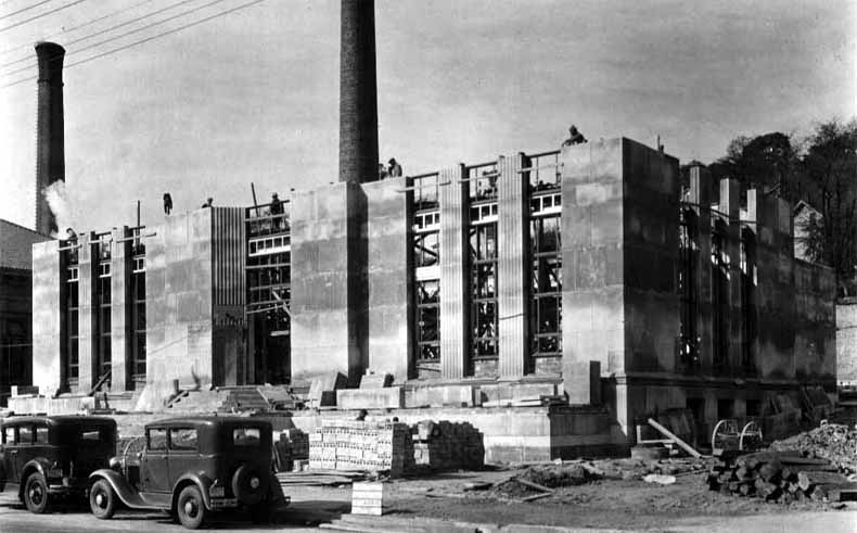
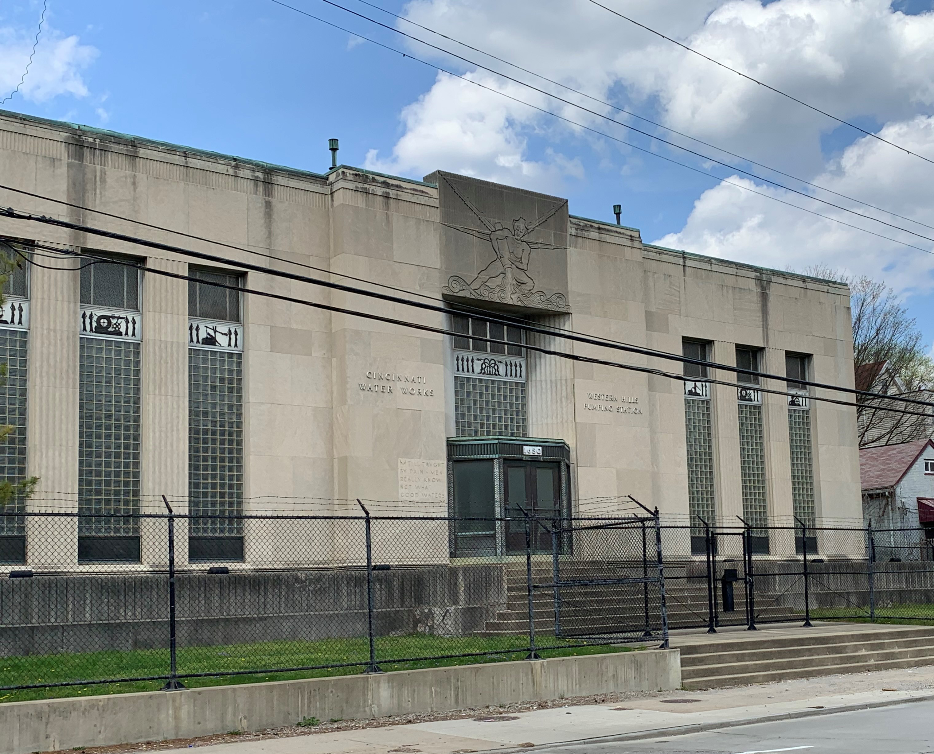
- The Western Hills Pumping Station at 1650 Queen City Avenue is another example of public infrastructure.
- Operated by Greater Cincinnati Water Works, the drinking water utility serving Cincinnati and most of Hamilton County, it was built in the 1930s as part of a New Deal grant to replace an obsolete steam-powered pumping station.
- Can you spot the Roman god of water on the front of the building?
TRAIL LOCATION K: GATEWAY TO THE WESTSIDE
The Western Hills Viaduct is one of the most distinctive bridges in Cincinnati with its intricate double-deck arrangement. It links the center part of the city to its west side neighborhoods, including South Fairmount and Westwood. The Viaduct has served as an important artery for millions of commuters since its construction in the 1930s.
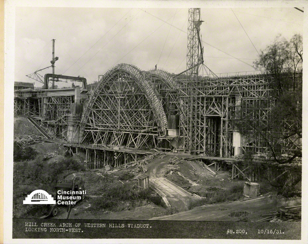
Dubbed the "Gateway to the Westside," it was designed for both automobile and streetcar use. Originally, streetcars and trucks used the lower level, with automobiles on the top level. Can you imagine sharing the bridge with a streetcar today?
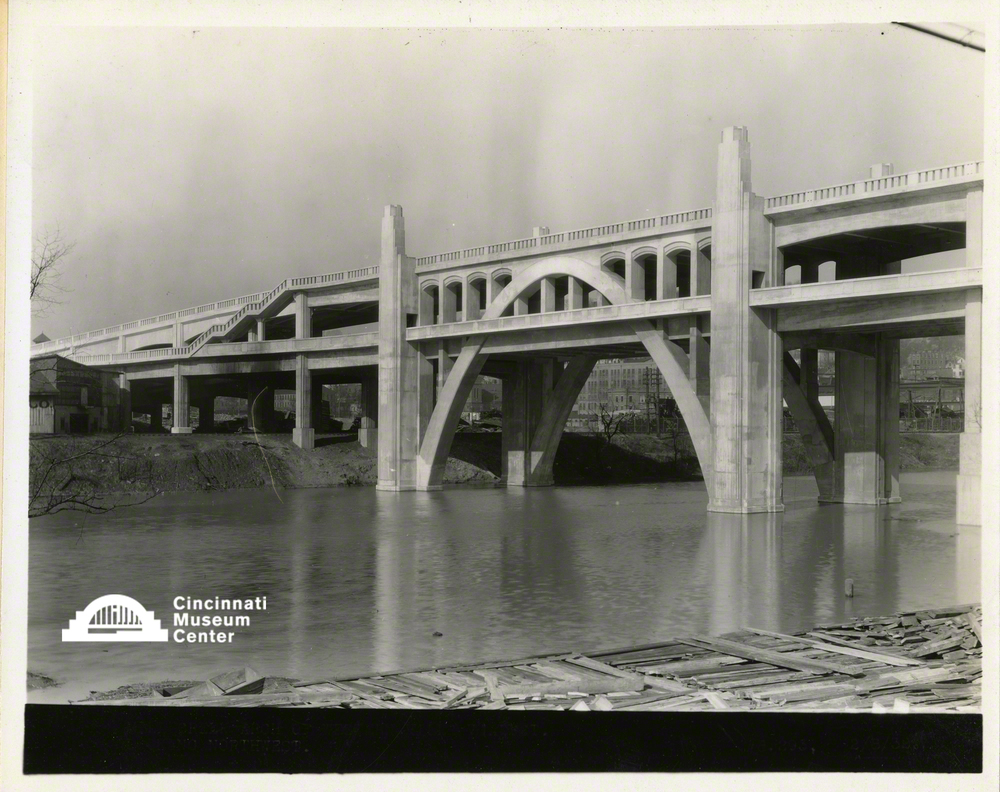
The Western Hills Viaduct originated as a joint project between the Cincinnati Union Terminal Company and the City of Cincinnati to create a more efficient and less congested alternative to the much smaller Harrison Avenue Viaduct, which could no longer accommodate the growing traffic to and from South Fairmount.
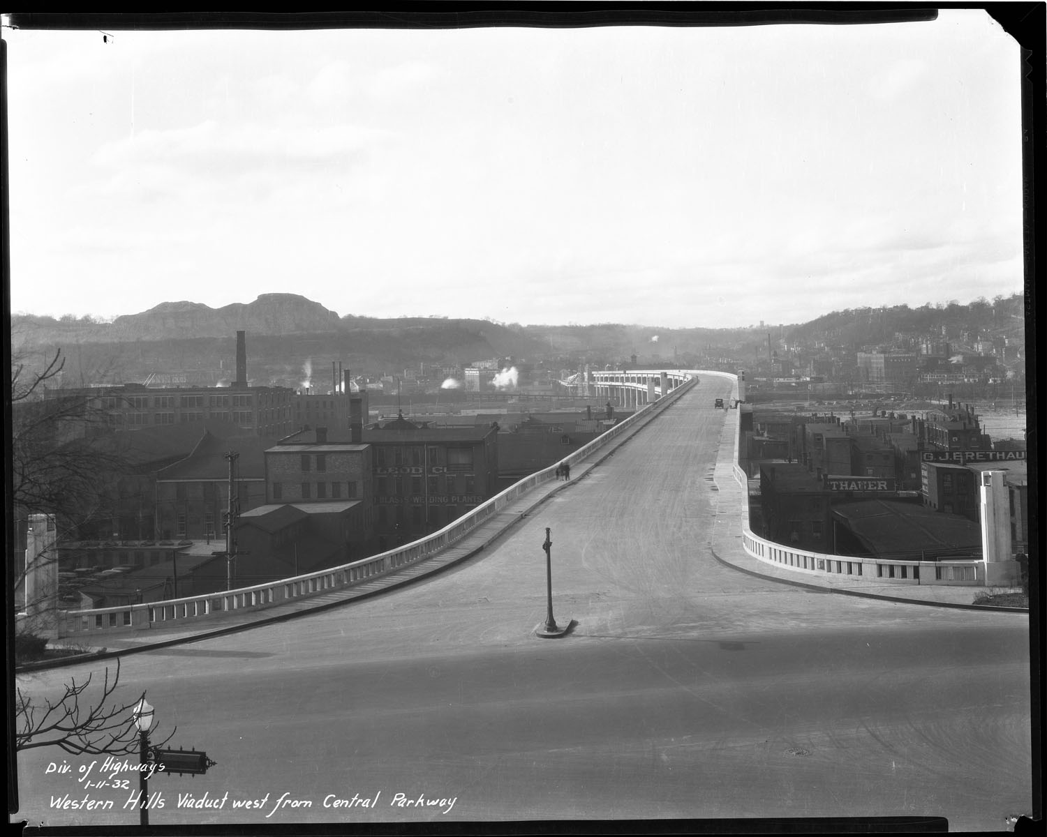
The Viaduct is currently the largest bridge in Cincinnati, crossing the Mill Creek valley between Spring Grove Avenue and Central Parkway and Queen City and Harrison avenues. Modifications to the Viaduct kept the artery accessible to the increasing demands of transportation, including a 1960s partial demolition to make way for the construction of Interstate 75.
The Viaduct is now nearing the end of its useful lifespan. The City of Cincinnati is currently designing a one-deck replacement bridge to be built to the south of the current location sometime in the near future, as funding is secured.
Voices from the Community
Buddy LaRosa on the Western Hills Viaduct:
TRAIL LOCATION L: FAIRMOUNT STREETCARS
In the 1850s, Cincinnati was the 6th largest city in the United States, with a population of 115,000 and growing. The city's boundaries continued to expand as people settled outside the downtown center and into the surrounding hills. Still decades away from the automobile, the new residents moving to the hillsides needed a way to travel to and from the city. The Cincinnati, Hamilton, & Dayton Railroad was the first to provide commuter service from South Fairmount (known as Fairmount until the 1920s) into downtown Cincinnati in 1851, but due to cost, it was not successful. With the arrival of the streetcar line, residents in Fairmount now had an efficient and cost-effective way to commute.
The original streetcars were horse drawn and began operating in Cincinnati in 1859 as one of the first in the country. Initially, the lines remained close to downtown, however, by 1880, the horsecar line expanded to include access to Fairmount. The convenience of transportation via the horsecar line made Fairmount an attractive alternative to city living, and the area saw a population increase of more than 1,400 new residents in a 10-year period.
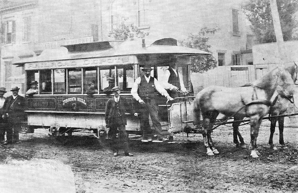
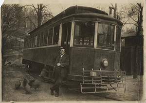
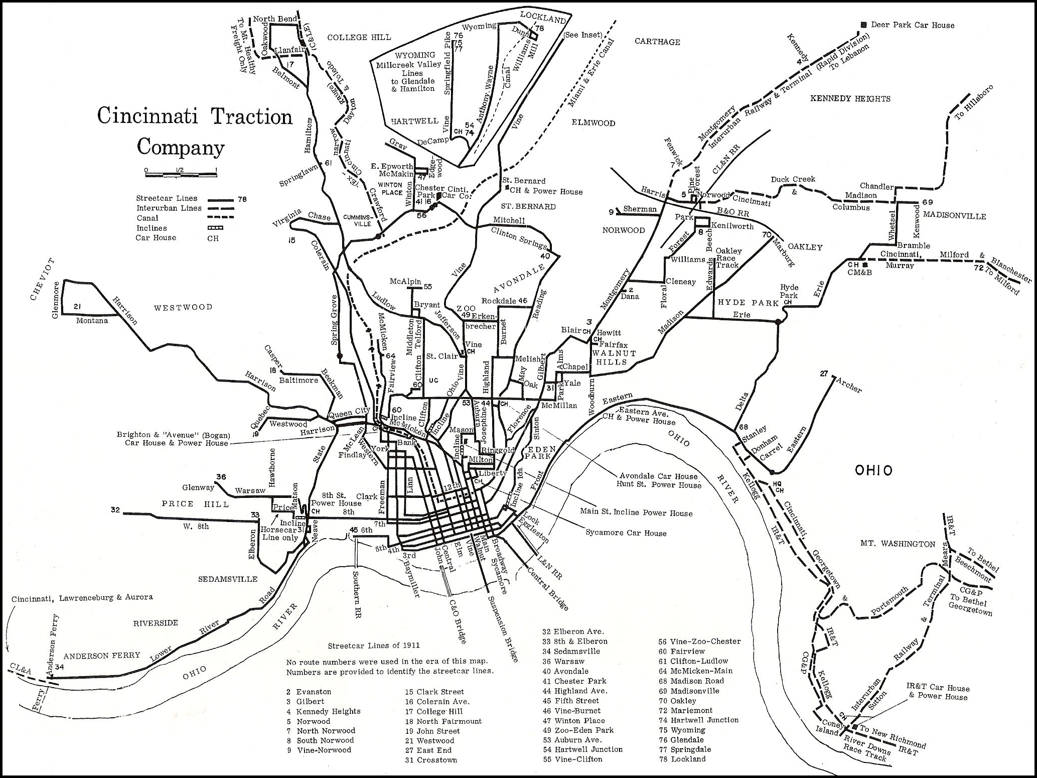
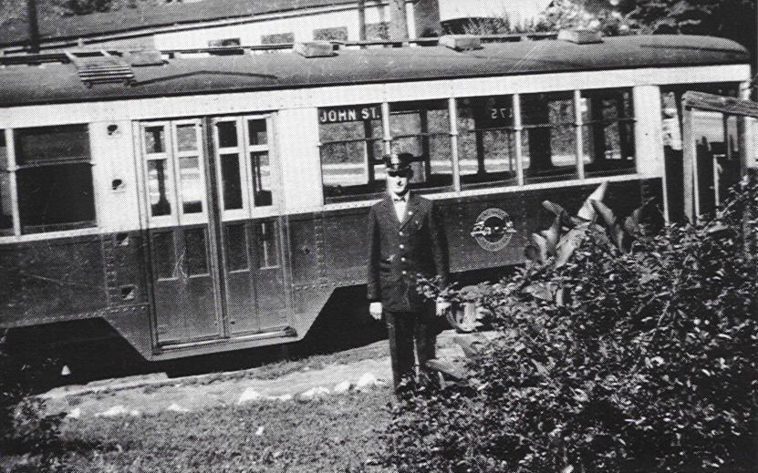
However, these first horsecar lines were plagued with problems. The hills surrounding the city were near impossible for the horses to climb under difficult weather conditions, and the horses would fatigue easily. Cable cars, and soon after, electric streetcars, began to replace the problematic horsecars by the 1890s. The first electric streetcar line in Fairmount ran along Westwood Avenue. These newer, more efficient lines once again fueled additional population growth and development in the Fairmount neighborhood.
As a result of the automobile boom, streetcars were functionally obsolete by the 1950s. However, residents from all over Cincinnati recall this mode of transportation with fondness. On hot summer days, some remember riding the streetcars to get some relief from the heat. Even the most mundane of daily life activities -— the morning work commute — is remembered with nostalgia: "Lots of people went to work on them. Many a courtship happened with the streetcar as the background," said Bill Meyers of Anderson Township, a longtime Cincinnati TV personality (The Cincinnati Enquirer, 2001).
For decades, the streetcar system in Cincinnati transported more than 100 million passengers a year. The streetcar was replaced by buses in the early 1950s, but ridership plummeted when Cincinnatians moved to the suburbs and bought cars. About 14 million passengers a year currently ride the Cincinnati Metro Bus System.
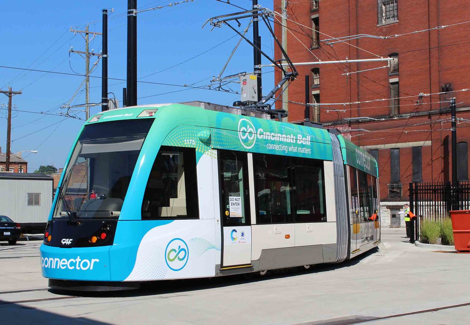
In 2016, Cincinnati revived its popular electric streetcar system on a downtown circuit only, but who knows what the future will bring.